Geography of Greenup County, Kentucky
Greenup County, located in the northeastern part of the state of Kentucky, is a region known for its scenic beauty, rich history, and vibrant communities. From its rolling hills to…
WIND EROSION DUE TO VEGETATION DESTRUCTION
The Oklahoma Panhandle forms the core area of a room that is severely affected by wind erosion. The former Indian territory was opened for settlement in 1897. The geometric, often chessboard-like division of many agricultural areas in the USA – to which traffic routes, settlements and land use plots are also subordinate – is a relic from this phase of planned land acquisition.
Because the natural vegetation was largely destroyed at the beginning of the 20th century, the process of soil runoff increased after the transition to cereal cultivation (especially wheat monocultures). Heavy rain, in particular, very quickly causes large-scale, linear cuts on sloping surfaces with destroyed vegetation.
Large areas of the short grass prairie were plowed up, especially in the late 1920s and early 1930s. The wheat farmers who moved there did not know that they were seriously and sustainably disrupting the ecological balance of the region in this way. Because of the low rainfall and the regularly occurring dry periods, the region was hit several times by major droughts, which led to catastrophic soil losses due to wind erosion in the very flat, almost tree-free landscape. Because of the notorious dust storms, the name “Dust Bowl” became common for the area. In addition, there was gully erosion, in which the draining water from heavy precipitation led to a deep fragmentation of the plateau areas and the formation of so-called badlands.
COUNTERMEASURES
To combat soil degradation, various measures were introduced that were coordinated by the Soil Conservation Service, a US federal agency. The gully erosion could largely be stopped by a targeted planting of the erosion channels and their edges. In some cases, dams are being built in the existing erosion channels, which hold back the water and thus slow down its erosion power after heavy rainfall. Plowing parallel to the contour lines, known as contour plowing, also reduces soil flushing after rainfall. Sloping terraces are also created for large slopes. The installation of windbreak hedges reduces the soil erosion by the wind.
The low rainfall in the Oklahoma Panhandle is also the reason for “dry farming”, a field cultivation method in which the rainfall from two to three rainy seasons is used to bring in a harvest. Another method of erosion protection, known as strip farming, cannot be seen on the map.
In recent times, large pig fattening facilities have been established in the Oklahoma Panhandle and the immediate neighboring areas in order to achieve higher added value than would be possible only with crop production. This is intended to improve the region’s economic base and reduce dependence on crop production. For more information about the continent of North America, please check zipcodesexplorer.com.
Greenup County, located in the northeastern part of the state of Kentucky, is a region known for its scenic beauty, rich history, and vibrant communities. From its rolling hills to…
Geography of Hamilton County, Iowa Introduction Hamilton County, located in central Iowa, is characterized by its diverse geography, including rolling prairies, fertile farmland, and meandering waterways. This area, rich in…
Lincoln County, Idaho, situated in the western United States, is characterized by diverse geography, ranging from rugged mountains to fertile valleys. This area boasts a rich natural landscape, influenced by…
Geography of Larimer County, Colorado Larimer County, located in north-central Colorado, encompasses a diverse and stunning landscape defined by its rugged mountains, rolling plains, pristine rivers, and shimmering lakes. From…
Hampton County, located in the Lowcountry region of South Carolina, boasts a rich geographical landscape characterized by diverse ecosystems, including rivers, forests, wetlands, and lakes. Its climate, influenced by its…
Georgetown County, located in the eastern part of South Carolina, is a region of rich history, diverse ecosystems, and stunning natural beauty. From its pristine beaches along the Atlantic Ocean…
Etowah County, located in northeastern Alabama, encompasses a diverse landscape shaped by its geography, climate, rivers, lakes, and other natural features. With a rich history dating back thousands of years,…
Geography of Jasper County, South Carolina Jasper County, nestled in the southern part of South Carolina, is a region of natural beauty and cultural significance. From its scenic Lowcountry landscapes…
Clay County, situated in northeastern Mississippi, is known for its diverse geography, rich history, and rural landscapes. The county is part of the broader region known as the Black Prairie…
Broomfield County, located in the north-central part of Colorado, is a relatively small but dynamic region characterized by its unique geography, diverse ecosystems, and vibrant communities. From its rolling plains…
Geography of Armstrong County, Pennsylvania Armstrong County, located in western Pennsylvania, is a region distinguished by its diverse landscapes, historic landmarks, and rich cultural heritage. Encompassing approximately 653 square miles,…

All cities and resorts of Antigua and Barbuda for travel. List of the most famous regions, regions, cities and resorts of Antigua and Barbuda: population, codes, distances, best descriptions and…
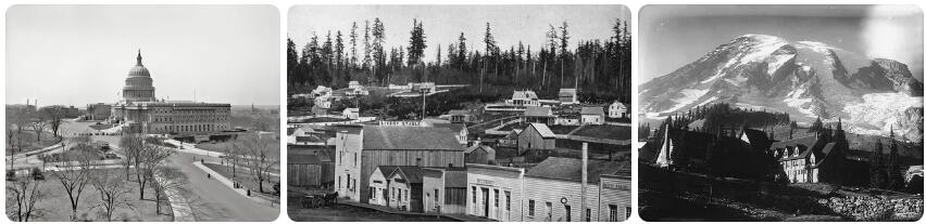
Early history A totem pole with the Thunderbird on top. According to beautyphoon.com, the area where Washington is located has been inhabited for centuries. The oldest find in the area…
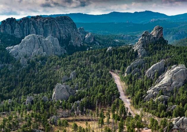
According to growtheology, South Dakota is the state with some of the most important attractions in America. National parks, memories of the wild west and traditions provide all the ingredients…
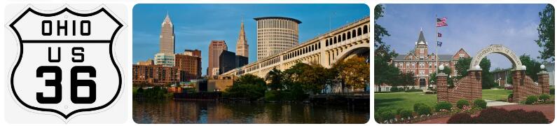
US 27 in Ohio US 27 Get started Cincinnati End College Corner Length 39 mi Length 63 km Route Kentucky Cincinnati Oxford Indiana US 27 is a US Highway in…
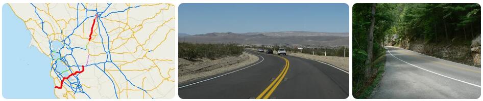
State Route 36 in California SR-36 Get started fortune End Susanville Length 249 mi Length 400 km Route Hydesville Mad River Red Bluff Mineral Chester Westwood Susanville According to toppharmacyschools.org,…
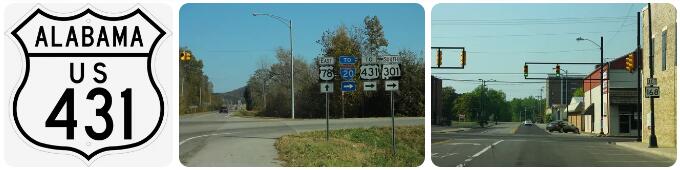
US 431 Get started dothan End Fisk Length 342 mi Length 550 km Route Dothan Eufaula Phenix City Opelika Roanoke anniston Gadsden Guntersville Huntsville Tennessee According to watchtutorials, US…

Colonial Period A map of Connecticut According to act-test-centers, before the arrival of Europeans, Connecticut was inhabited by several peoples, including the Nipmuc, the Pequot, and the Paugusett. The first…

Hardly any other place is so associated with immigration to the USA as Ellis Island. For millions of people the dream of a better life in the USA began here…

Airports San Francisco is served by 3 airports: San Francisco International Airport, San Jose International Airport and Metropolitan Oakland International Airport. San Francisco International Airport is about 12 miles /…
Sugar cane, introduced in the archipelago since 1837, is today the main crop. In 1915, 55 plantations produced 811,000 tons. and the export yielded $ 70 million. The cane is…
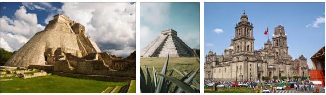
The true monuments of antiquity in Mexico are the pyramids. There are many of them in the country, but only a few are available for viewing. Many pyramids are buried…

Santo Domingo For tourists who are looking for a diverse vacation, the Dominican Republic will offer its capital – Santo Domingo. This is an old colonial city founded by the…
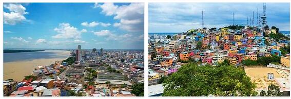
Guayaquil Guayaquil is the capital of the province of Guayas, the country’s first port and one of the largest ports in the Pacific Ocean. Situated at the mouth of the…
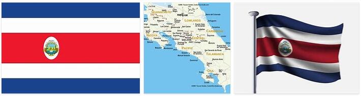
The Republic of Costa Rica is a small mountainous country located almost at the narrowest point in Central America. It borders Nicaragua to the north and Panama to the south. It…
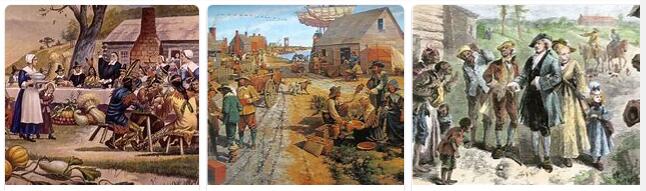
The Declaration of Independence of July 4, 1776, signed by the 13 English colonies in North America (New Hampshire, Massachusetts, Connecticut, Rhode Island, New York, New Jersey, Pennsylvania, Maryland, Virginia, Delaware, North Carolina,…
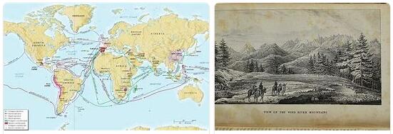
The Norman navigators who, at the dawn of the century. XI, from Norway and Greenland they certainly reached some strips of North America, they probably descended towards the south so…

Army. – The large units that make up the United States army today are: 5 infantry divisions (of which 2 are located respectively in the Hawaiian Islands and the Philippine…

14 days on the road in a 4×4 jeep In April 2017 our customer Gundi Bohn is going on the Pura Vida rental car tour in Costa Rica. Come across…

Trinidad and Tobago – Travel in the Country Airplane: According to thesciencetutor, Caribbean Airlines operates the route between Trinidad and Tobago. Flights between Trinidad and Tobago take around 20 minutes…

Agriculture FAO’s most important area of activity is agriculture. The organization works to increase agricultural production in several different ways. This can mean, among other things, that more soil is…
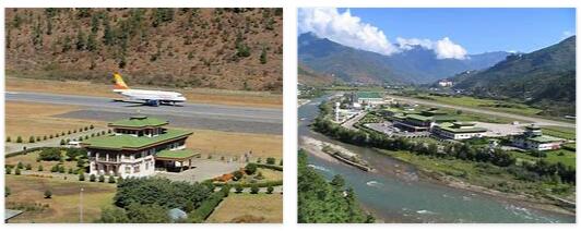
Fast your seat belts! Short runways, steep slopes or unpredictable fall winds. There are airports where pilots and passengers alike need nerves and cables to approach. Toncontin International Airport in…
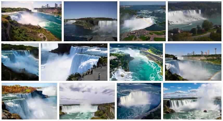
When is the best time to visit Niagara Falls? The best time to visit Niagara Falls is from April to October. During these months, mild to quite warm temperatures await…

Montego Bay has white sandy beaches and a laid back holiday atmosphere. Montego Bay has some of the most famous elements of the Caribbean – white sand beaches, reggae rhythms…

The United States is a diverse society, and so is religious life. Christianity is the dominant religion, around 70 percent of the population belongs to a Christian denomination. The first…

Population Trinidad and Tobago has an average population density of 273 residents per km2. A significant emigration means that the country was not expected to have any population increase. The…

In February 1995, 3 men charged with murder were hanged. The government on the occasion lifted the ban on the death penalty, which had been introduced several years earlier. A…

Population Saint Lucia has a population density of 295 residents per km2, but almost the entire population lives on the coast. In 2019, 19 percent of the population lived in…

In June 1992, the Opposition Party, the Movement of Conscious Citizens, won the election on Nevis and conquered Nevis’ Reform Party’s 3 seats in parliament. That same year, Governor General…

Population Panama had an average population density of 54 residents per km 2 in 2019, but the country is unevenly populated with the greatest concentration to the area along the…